
| Old Sodbury to Wotton-under-Edge | Back to Cotswold Way index | Stroud to Cranham |
| Old Sodbury to Wotton-under-Edge | Back to Cotswold Way index | Stroud to Cranham |
The market town of Dursley lays roughly halfway along the route and gives an opportunity to break it into two half-day expeditions. The day ends at Stonehouse, laying within the valley of the river Frome just west of Stroud. Stroud itself is a handsome town, a useful public transport hub as well as a place to stay, eat and stock up. Both Stroud and Stonehouse are on the railway network, on the line from Gloucester to Swindon.
|
|
|
| Length: | 14.9 miles / 24 km |
| Total ascent: | 2734 ft / 833 m |
| Total descent: | 2876 ft / 877 m |
| Estimated time: | 5 hrs 42 mins |
Click
on
any thumbnail image in this gallery to display the corresponding full
size
image. The images are access protected through a cgi script to prevent
hotlinking. If you encounter problems while trying to view the full
size
images, please read the access advice
page.


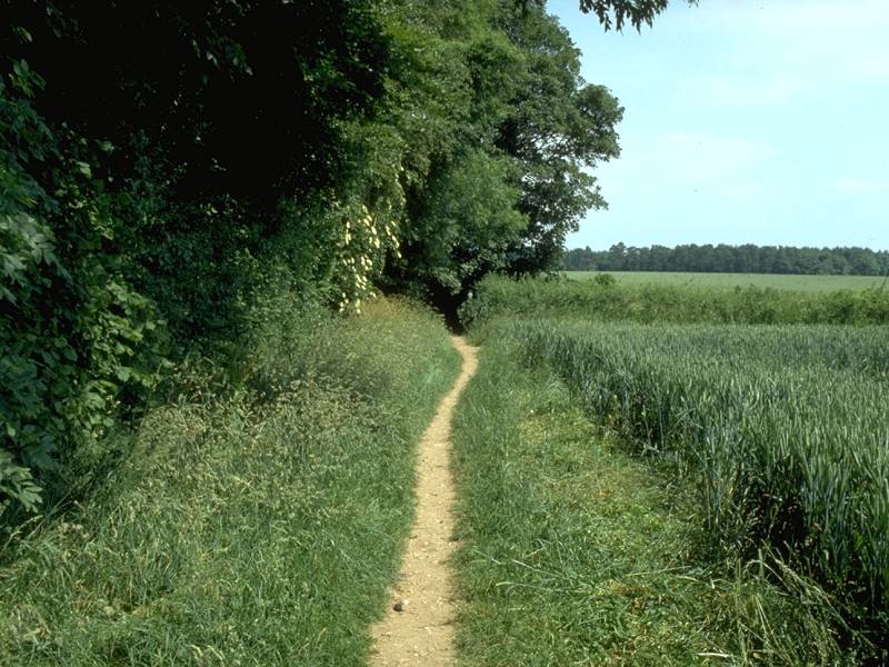
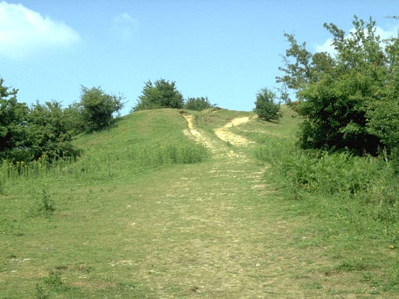
Wotton from Wotton Hill; view westwards across the Severn vale
Your first objective this morning is the very obvious hill rising directly from the north western fringes of town. Wotton Hill is a most pleasant top, an area of downland with light tree cover affording excellent views around the whole western arc. The scarp back as far as Old Sodbury is seen pretty much end-on, while to the west and northwest you get an excellent view of the Severn vale with the Forest of Dean beyond. Chepstow castle is just fourteen miles away, on the Welsh side of the water - those with keen eyes might well spot it. The towers of the Severn bridges should be well in view to the southwest.
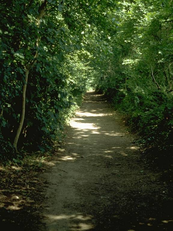

Paths beside and through the woods of Westridge
Wotton Hill proves not to be an isolated hill but a section of the main scarp, which continues northwards as Westridge. Initially the Cotswold Way runs along the east side of the woods, denying you any further views of the Severn vale. After the first mile the woods spill across the route and your way now lies along a broad pathway running through broadleaved tree cover. This area is popular with those on horseback as well as those on foot.


Two miles out of Wotton the path emerges onto Nibley Knoll, a triangular shaped area of grassy pasture surrounded by woodland on just about every side. There are excellent views back along the scarp to the south. At the western apex of the knoll is a stone tower, a monument to William Tyndale. Tyndale was the man who translated the Bible into English. The tower dates from 1866 and is therefore relatively modern. Tyndale was supposedly born near here but he actually spend his formative years at Little Sodbury Manor, a day's walk back. He worked on his translation of the New Testament there, between about 1521 and 1523.


Descent from Nibley Knoll into North Nibley
The route off Nibley Knoll is obvious enough, a short but steep plunge down the scarp by way of a flight of steps, leading to an unclassified road just outside the village of North Nibley. Your route leads through the village on the road to the northwest; North Nibley itself is neat, charming and serene. At the northwest extremity of the village take the short road to the right, heading due north; this quickly becomes a track, which converges with a motor road to the left after about half a mile. There's a short but intricate section of road walking here; almost immediately to your right is a road junction, from which follow the road leading north and then around a sharp curve to the right. Shortly after the curve leave the road for a path to the left, crossing a meadow on a bearing just east of north, with the prominent hump of Stinchcombe Hill directly ahead of you.

Approaching Stinchcombe Hill
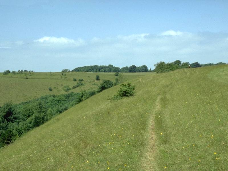


The Cotswold Way on the lip of Stinchcombe Hill
The path first skirts the western side of the steep spur od Stinchcombe Hill rising northwards from Nibley, and then climbs it steeply on a diagonal. The top of the hill is revealed to be a flattish top at a general elevation of 200 metres. The hill has a complex shape, though could broadly be described as a north-south oblong on about 1200 by 400 metres, with a star-shaped protrusion on its western side. The main "oblong" is the site of a golf course. The Cotswold Way runs along the western edge of the golf course then heads out around the rim of the western protrusion, running all the way around it for 1.5 km before returning almost to the same spot. An Ordnance Survey triangulation pillar sits at the southwestern point of the star, marking the 219-metre summit of the hill.


Views back to Nibley Knoll and across the Severn vale, and the OS trig point on the summit
The journey around the "star" is a little curious in that it keeps mainly just below the lip of the summit plateau, affording little view across it. The views from it, however, are extensive and are similar to those from Nibley Knoll two miles to the south. The Severn vale occupies most of the view.

Once you reach the northern edge of the "star", follow a prominent track towards the centre of the "oblong", passing within a few feet of your outward route. Turn half right onto a track heading southeast and bypassing the golf course's clubhouse to its right. Once pass the clubhouse turn left for a path that plunges into the woods and heads smartly downhill, emerging after 400 metres at the head of a residential road on the outskirts of Dursley.


Entering Dursley; pastures at Home Farm; approaching Downhouse Farm
Dursley is a market town that nestles within a bowl formed by a complex incursion into the Cotswold scarp. I would guess that it has a population of around ten thousand. Dursley, like Wotton, was a mill town though nowadays it seems to make its living by light engineering. Although it generally doesn't have much to grab the eye it is the first town along the route to boast a market house, basically a roof supported by a series of pillars to provide a covered trading area. Dursley's market house dates from around 1730 and is a handsome structure, though there is a finer and much more famous one at Chipping Campden at the northern end of the Cotswold Way.
Using the map make your way to the town centre, then along the road to the northeast towards Home Farm on the edge of town. From the farm the Way follows Drakes Lane, which isn't terribly obvious on the ground but runs within pasture parallel to a motor road. The route then doglegs out onto this road and follows it past the locality of Fairfield. It then re-enters pasture to the right as far as Downhouse Farm, still pretty much on the edge of town, then turns left along the road for a few paces to come to the western spur of Cam Long Down.


Cam Long Down, and the views to the south and northwest
Cam Long Down is an isolated wedge of hill, actually a detached outlier of the main Cotswold scarp. It forms a bow-shaped lump of high ground about 1200 metres long by 300 metres wide and lies very roughly east-west though with a right-hand curve. It rises to a height of around 220 metres, a hundred metres or 330ft higher than the surrounding farmland. The Cotswold way climbs its western spur directly from Downhouse Farm and traverses its whole length. The vegetation is downland verging on heathland; what looks at first like a carpet of fairly good turf turns out to be a habitat for clumps of gorse and a particularly spiteful variety of low-growing thistle. Views are extensive once again and encompass the whole of the Dursley / Uley bowl, nestling within cradling arms of the Cotswold scarp. There is another detached hill, Downham Hill, immediately to the south. The view is open out to the northwest across the vale of the Severn towards Gloucester. To the north you will see the general line of the scarp towards Cheltenham, with the mouth of the Frome valley visible a few miles away.


The Cotswold Way on Cam Long Down
From the eastern end of Cam Long Down there's a steep little drop to a col occupied by Hodgecombe Farm, then an equally steep pull up to the main scarp at the neck between Uley Bury (to the south) and Crawley Hill (to the north).
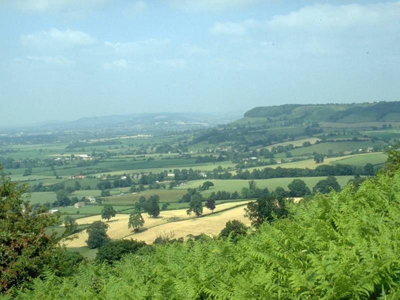
Gloucester and the mouth of the Frome valley; the col between Cam Long Down and the main scarp

The Cotswold way in Buckholt Wood
There are about four miles still to walk and it's something of a pity that the recreation area lays where it does; the chances are that you will have reached it at around 3.30 to 4pm and found that it represented a psychological end-point to the day - these last four miles can therefore be a chore. This pattern will repeat itself tomorrow when you reach Painswick at much the same time.
The Cotswold Way runs northwards away from the downs and through an area artificially planted as a nature reserve before tending to merge with the road again. At this point you reach the mouth of the Frome valley, one of the major incursions into the Cotswold scarp. You re-enter the scarp's ever present ribbon of woodland here, known locally as Buckholt Wood. The path curves to the right and heads north-eastwards for about a quarter of a mile, then curves further to the right above Sandford's Knoll.


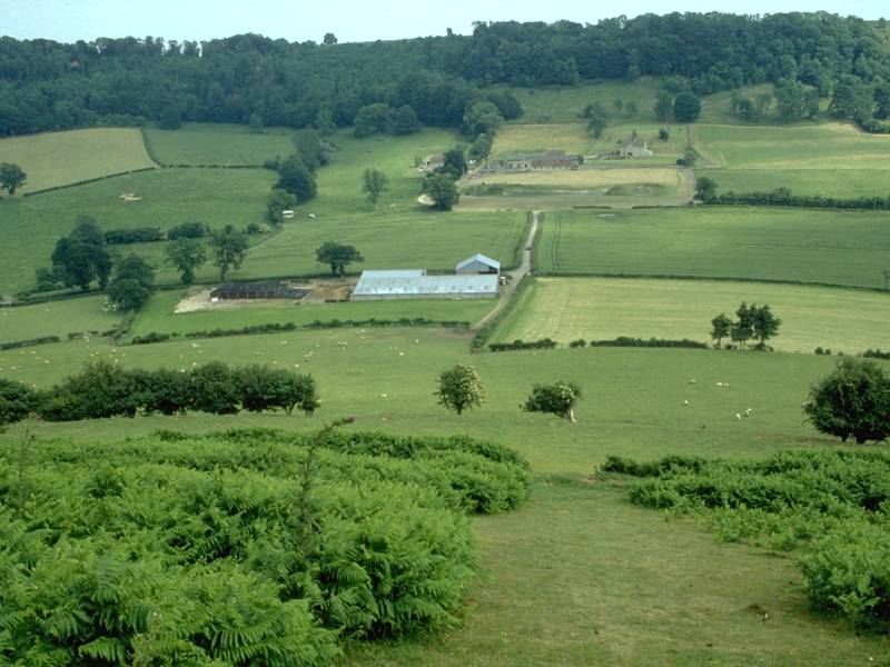
The path is running generally eastwards now, along the slopes that form the southern side of the Frome valley, but the complications are not over; these slopes have their own little collection of spurs and coombes and the path is continually curving left and right to track around them. Here and there the path leaves the area of tree cover to track across heathland slopes, giving views out across the Severn vale, and of Leonard Stanley, King's Stanley and Stonehouse, the settlements at the head of the Frome valley.


After re-entering the woods the Way runs around the head of a huge coombe southeast of Leonard Stanley, describing a wide left-hand curve. You end up walking north as the curve straightens out, and at this point you're within the mature woodlands of Pen Wood, about halfway up the slope of the western side of the spur of Pen Hill. The path now enters an equally languorous right-hand curve as it tracks around this spur. Half way round, at the apex of the spur itself, is a prominent track crossing; turn left here for the path straight down the spur to the north.

The Cotswold Way near Middleyard
The path emerges from the woods at the foot of the spur, just short of the village of Middleyard. The Cotswold way takes a complicated little route through farm pastures to the east of the village but it is rather more straightforward to stay on the lane and reach the village centre direct. Only about 300m of open country separates Middleyard from the twin villages of Leonard Stanley and King's Stanley.
| Old Sodbury to Wotton-under-Edge | Back to Cotswold Way index | Stroud to Cranham |
This page last updated 31st January 2004
![]()