
| Temple Cloud to Bath | Back to Cotswold Way index | Old Sodbury to Wotton-under-Edge |

| Temple Cloud to Bath | Back to Cotswold Way index | Old Sodbury to Wotton-under-Edge |
|
|
|
| Length: | 18.6 miles / 30 km |
| Total ascent: | 2353 ft / 717 m |
| Total descent: | 2038 ft / 621 m |
| Estimated time: | 6 hrs 35 mins |
Maps: OS 1:25000 Explorers 155 (Bristol & Bath), and 167 (Thornbury, Dursley and Yate)
Click
on
any thumbnail image in this gallery to display the corresponding full
size
image. The images are access protected through a cgi script to prevent
hotlinking. If you encounter problems while trying to view the full
size
images, please read the access advice
page.
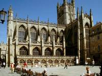
Bath Abbey
The environs of Bath Abbey
Bath has already been described, and pictured to some extent, on the previous page (Farrington Gurney to Bath) so I'll not repeat too much of the narrative here. Bath began life some two thousand years ago as a Roman spa town ("Aquae Sulis", which translates roughly as "Waters of the Sun"). Its abbey made it an important ecclesiastical centre for several centuries but it was in the eighteenth century that a new fashion for healing waters among Britain's aristocracy brought Bath back into prominence. Bath's present appearance dates from that era; the city centre is largely composed of beautiful Regency terraced townhouses in Cotswold stone, the work of architects such as Nash and John Wood. The Royal Crescent, just outside the town centre to the north east, is the first, largest and finest Regency terrace in Britain.
The Roman bath house and surrounds
The Roman bath house is a reconstruction but it is built around the original baths, and is a noted tourist attraction. The city itself, apart from its historical and architectural riches, has good "vibes"; it's a lively place, full of character and interest, a place of street theatre and art shops and poky back lanes and closes full of eccentricities and oddities. It deserves a days' exploration.
Bath's back lanes
The Cotswold Way begins officially at the close to the rear of the Abbey, a structure which dates partly from 1499. Although the CW takes an official route through the town centre don't feel constrained by it - there is plenty to see. Basically, you should go around to the northwest corner of the Abbey and make your way westwards to the Roman baths, then go northwards uphill along Bath's main shopping street (meandering along the lanes as you choose). The next main highlight is the Circus, a circular open space surrounded by superb examples of Regency terracing featuring classical columns within the facades. It's a little difficult to portray in photographs, mainly because the central grass island is home to several mature trees, but rejoice in the knowledge that a number of famous people have occupied these houses - including William Pitt, the explorer David Livingstone, and the painter Gainsborough.
The Circus
From the Circus head west again along Brock Street to the gardens at the far end. On the north side is the Royal Crescent.
Royal Crescent
The Royal Crescent is Britain's largest Regency terrace, built by John Wood in 1774. It's a sad fact that nowadays, at any given time, part of the terrace will be undergoing restoration work and will be covered in scaffolding. It's best seen from across the gardens on its south side, which not only provide a lively foreground of flowers and shrubs but also allow you to appreciate the terrace's sheer scale. From here go further west, across the road into Royal Victoria Park.
Royal Victoria Park and the entrance to the golf course
The park itself contains the city's botanical gardens and is worth a couple of hours' exploration on its own terms, but perhaps they should be included as part of a full-scale exploration of Bath on a rest day. As soon as you reach the Victoria monument just inside the park turn right and take the surfaced walk uphill close to the park's eastern edge. You come out on Weston Road, and almost opposite you will see the gated entrance to the Bath city golf course. Alongside the gates is the first Cotswold Way fingerpost, which directs you along a path heading diagonally uphill across the golf course. The path is fenced on one side and is shaded by a line of trees
Crossing the golf course, and Summerhill Road
At the top end of the golf course you find yourself in a quiet little residential road called Sion Hill. Follow this road around a right hand curve, go uphill to the top of the road and then turn left into Summerhill Road, following it to the west. At the far end of Summerhill Road you're almost out into the pastures at the edge of town, and the route of the CW is led along several walled gravel paths grazing the ends of more residential roads.
Walled path beyond Summerhill Road
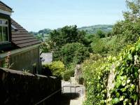

You're now out of Bath proper and have entered Weston, originally a separate village that has now been swallowed up by Bath's expansion and is effectively a suburb of the city. You descend a flight of stone steps and find yourself in the very ordinary residential road of Purlewent Drive; follow this eastwards for about 300m, keeping an eye open for the Cotswold Way marker that will direct you into the tiny lane of Church Road to the left.
The route through Weston is a little complex and is not well signed. Towards the end of Church Road go left into the churchyard and skirt the church itself, keeping it to your right. Take the path and steps leaving the churchyard to the south, which will deliver you to the point from which the middle picture above was taken, just to the east of Weston High Street. Make your way to the High Street itself. To your left is a back street and just left of that is a main road on a high viaduct. Follow the High Street to a complex junction at its far end and turn right for a brief but steep pull up a lane that quickly merges with a road from the left and becomes Pen Hill Road. Walk southwest along this road for about 400m until the houses on the right give way to pastures. Go immediately through a stile and turn half right, to head directly across the pasture for the little wooded knoll of Pen Hill.
Weston from Pen Hill; a retrospective view of Bath; Pendean Farm
The path climbs Pen Hill, whose 399ft elevation gives it a splendid view across both Weston and Bath. Penn Hill proves to be the southeastern end of a ridge of high ground, and the Cotswold Way now follows this ridge for the next mile and a bit. The path is lined by a hedgerow and a fair number of trees. The going is good as far as the little dip in which Pendean Farm lies, though after that you reach a seam of heavy clay soil that will stick to your boots like liquid lead during or after rain.
The Cotswold Way west of Pendean Farm
The path heads for the 714ft Kelston Round Hill but the right of way doesn't climb it, skirting it instead to the northeast. Since I first came this way, however, the landowner has provided a permissive path that allows you to reach the summit of the hill from the east. If you visit the top of the hill, be sure to follow the correct line of descent by a second permissive path to the north, which rejoins the official Cotswold Way lower down. The CW turns right here, tending just east of north, to run across the head of the Upper Weston coombe towards Prospect Stile.
Approaching Kelston Round Hill; a first view of Bristol to the west; the path approaching Prospect Stile
Kelston Round Hill and Upper Weston Coombe from Prospect Stile
Extensive views open out to the east, south and west as you follow the path through a couple of gates. As you draw level with a slope up to your left the path doglegs a little to make its way up the bank. At the top of the slope is a gate in the middle of a length of fencing, and just in front of the fence is a wooden bench seat. You've arrived at Prospect Stile, which is as good a place as any for your mid-morning break.
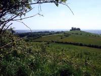
Kelston Round Hill from Prospect Stile
Prospect Stile lays on the southern edge of Lansdown Hill, an area of virtually flat tableland which is home to Bath racecourse and to the second golf course of the day. The stile itself enjoys some splendid views, hence the name; to the southeast you look down the Weston coombe into Bath itself, while to the west you can clearly see the sprawl of the city of Bristol. The line of the Mendips is well seen to the south, the white tubular structure of the Mendip TV mast fixing the position of Wells in the landscape.
Go through the gate adjacent to Prospect Stile and walk northwest along the field boundary, which you keep to your left. Within moments you pass the starting gate and rails of one leg of Bath racecourse. The grandstands at the hub of the course are just over half a mile away; they will continue to be half a mile away for the next hour or so, as the Cotswold Way tracks more than half way around the course. Go through a stile at the far end of the enclosure and continue to follow the path, which is rougher now and enclosed by rank vegetation. After some 300 metres the field boundary and the path both turn right, and after a further 250 metres the route turns left through a gap in a low stone wall. You now come out onto a spur of high ground known as Little Down, the first viewpoint on the Cotswold Scarp proper.
The path alongside Bath racecourse
Little Down stands just above the tiny village of North Stoke, which looks charming from up here. Bristol is well seen again, but here the main arc of the view is to the west and northwest, a situation that will be repeated countless times over the next few days as you progress along the line of the Cotswolds. The silvery ribbon of the Severn may well be seen, and perhaps you might be able to make out the towers of the Severn bridges that take the M4 motorway across into Wales. The dark line on the skyline to the northwest is the Forest of Dean. On exceptionally clear days you might be able to see the Black Mountains (hills really, rising to not far short of 2000ft) just across the Welsh border.
The path off Little Down
You approached Little Down from the southeast. Turn hard right, through a good 150 degrees, and head east alongside a hedge just up to your right. This is the next stage of your traverse around the edge of Lansdown Hill. The path dips slightly to merge with a track coming up from North Stoke, then rises again to run along the southern boundary of Pipley Wood. The Lansdown Hill golf course is seen to your right.
The Cotswold Way in the vicinity of Lansdown Hill golf course
The Cotswold Way spends around three quarters of a mile in the vicinity of the golf course. The map shows the path curving around Pipley Wood, keeping the golf course to your right, but in fact the waymarks direct you onto a path heading east across the course towards the southern apex of a triangular area of woodland. Once you reach this corner turn left and walk alongside this wood, keeping it to your right; the golf course is now to your left. Continue along the track for some 500 metres. The adjacent area of the golf course is in the shape of an inverted "V" and you're rapidly approaching the northern apex. At the far corner dogleg right and left through a gate and follow the path across a small area of rough ground. At this point you leave Bath & Northeast Somerset and enter South Gloucestershire. Turn half left, following the lip of the scarp once again, along a fieldside path heading for the viewpoint of Hanging Hill.
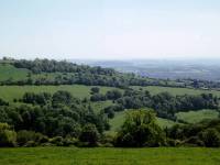
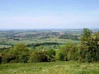
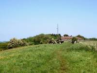
Hanging Hill is another viewpoint at the apex of a wedge of high ground standing proud of the general line of the Cotswold scarp; like golf courses, you are going to meet a fair number of these over the next week. A trig pillar stands just within the trees on the other side of the fence; the map gives it a height of 235 metres, or around 775ft. Once again there are splendid views of Bristol, the lower Severn vale and the Forest of Dean. The Cotswold Way now swings sharp right again to take path heading around the north side of the field you just walked beside. Head for the radio mast a couple of hundred metres away to the east.
The Cotswold Way at the radio mast; crossing the Lansdown road.
When I first passed this way in 1992 the radio mast was a facility of the Royal Observer Corps, but nowadays it's employed by the local fire service. Keeping the mast and its service buildings to your right, walk past to find a driveway hugging the southern edge of Beach Wood. At the far end of the wood you come out onto the Lansdown road, a remarkably straight highway that must surely be Roman in origin. Amazingly, it's unclassified, but it's straight enough and wide enough to attract a fair volume of traffic. Follow the slip road about 150m to the south, then cross the road at a Cotswold Way fingerpost (3rd picture, above) for a short track across rough pasture heading northeast towards a wood. You're now briefly back inside Bath & Northeast Somerset, but not for much longer.
From the monument the Way takes a slightly complicated route and you should keep a close eye on the map and on the waymarks. The path goes half right at the side of the wood then follows the enclosure round in a curve to the right, before going left over a stile where you get a splendid view into the Langridge coombe to the south. (It's not actually named on the map but the valley falls from Langridge (="Long Ridge"?) and it seems as good a name as any. Those with local knowledge are invited to contact me with any info.) Once across the stile you follow the path downhill, veering left then right alongside hedgerows. Watch out for a left fork shortly after the right-hand curve - the turnoff is a lesser path and is easy to miss. If you find yourself heading along a long, straight farm track tending downhill between hedges, then you've missed your turn. Cross a stile to take a path heading diagonally across a series of pastures to the northeast, downhill towards Hill Farm.
The Cotswold Way at Langridge

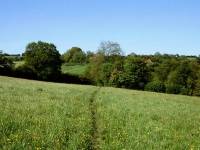
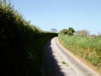
The approach to Hill Farm, and Greenway Lane
At the first field boundary after the stile you leave Bath & Northeast Somerset behind for the second and final time. You run down two beautiful downland pastures to reach a footbridge across a brook. Halfway down the first of these pastures you will find a bench seat, which I utilized as a lunch stop when I first came this way in '92. Once across the brook the Way doglegs left then right, to continue along a straight line in the same NE direction across more pastures before going down into another dip to cross a rather more substantial brook. Now follow the path steeply uphill past Hill Farm. On the ridge ahead of you you'll see the flow of traffic; the A420 Bristol - Chippenham road is up there, and it carries a bus route which you will meet at Cold Ashton and which provides an opportunity for cutting the walk into two should you so wish. A little way beyond Hill Farm you reach tarmac; you're on the unclassified Greenway lane, which the Cotswold Way follows uphill along a gentle right hand curve towards Cold Ashton.

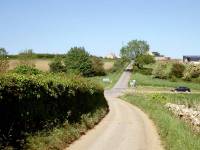
You cross the A46, a road that you will meet many times over the next few days, to approach Cold Ashton from the west. There isn't much to Cold Ashton but it's a charming village and carries quite a refined air.
Cold Ashton
The old rectory; turn left into the churchyard; Cold Ashton church
Towards the end of the village turn left, through the churchyard, onto a path that comes out on the main A420 road by the White Hart inn. There is a bus stop here, if you wish to break the journey and travel to Bristol or Chippenham.
![]() First
Badgerline service 635,
Chippenham - Cold Ashton - Bristol
First
Badgerline service 635,
Chippenham - Cold Ashton - Bristol
(Cold Ashton is not shown on the timetable but is halfway between
Wick and Marshfield)
The White Hart
Go slightly west, beyond the pub's adjacent cottages, and take a footpath forking off to the right. This path heads smartly downhill across fields and curves to the right, to merge with the A46 again at a locality called Pennsylvania.
Field crossings between the White Hart and Pennsylvania
Pennsylvania
Keep following the same path beyond the A46, in the same direction. After some 500m it reaches Gorse Lane, an unclassified lane that is the continuation of that road up from Bath via Lansdown Hill which we've already met several times today.
Turn left to follow a fieldside path parallel to the road, southwestwards for about 150m, then turn right and cross the road for a path heading for Dyrham Wood.
Dryham Wood
At the far side of the wood you reach the dip of Withy Bed, after which the path leads you on a tiring climb over a spur of land overlooking Lower Ledge Farm to the west.
Withy Bed
The CW crossing the hill south of Dyrham
You cross a second dip, just downhill from Sands Farm, and walk briefly alongside a pond. The path then ascends slightly to the slopes of Sands Hill, where you enter the village of Dyrham from the south.
Sands Hill
The Cotswold Way approaching Dyrham
![]() First
Badgerline service 634,
Bristol - Dyrham - Tormarton
First
Badgerline service 634,
Bristol - Dyrham - Tormarton
The village itself is small and is pleasant enough, but it is dominated by Dyrham Park, a National Trust owned stately home with a couple of square km of surrounding parkland. The house is of mixed antiquity, partly Tudor and partly Georgian. The later part is the work of Talman, a contemporary of Christopher Wren. The house sits within a complex little coombe that cuts into one of the steepest parts of the Cotswold scarp and the setting is quite dramatic.
Dyrham village
Dyrham Park and the park boundary wall
Follow the CW through the village and then take the path that curves around the perimeter of the park, running uphill into another steep little coombe above the village of Hinton.
Hinton Coombe and the boundary of Dyrham Park
At the top of the scarp you meet, and turn left into, Field Lane. The lane runs north for some 400m, ending at a T-junction with an unclassified road. From the T-junction take a footpath to the north. This path runs parallel to the top of the scarp but a little way back from it, so views are limited to the distant horizons of the Forest of Dean. After about 1100m the path turns right, heading more or less east, along the north side of a strip of hedgerow that quickly develops into a narrow ribbon of woodland. You will no doubt hear the roar of traffic to your left, and a glance at the map will tell you that you are close to the M4 motorway.
Field Lane
Footpath north of Field Lane
The path running parallel to the M4 motorway
The A46 and the M4 motorway at Tormarton interchange
There's another 300m of the A46 to follow once you're safely across the M4, but after this stretch you turn right onto a lane into the village of Tormarton, about a mile to the east. The roar of traffic dies down quickly.
Approaching Tormarton
Tormarton village
![]() First
Badgerline service 634,
Bristol - Dyrham - Tormarton
First
Badgerline service 634,
Bristol - Dyrham - Tormarton
It's far from obvious why the CW is routed through Tormarton, for it represents a detour; once through the village you have to walk back to the west to cross the A46 again into Dodington park. Tormarton does have a pub, of course, and it also has a tea garden open at weekends. Purists might wish to follow the exact course of the CW, which takes a complicated route between and around the cottages in a futile attempt to avoid tarmac. Non purists will notice at least two opportunities to bypass Tormarton to the west, either by country lane or footpath; you can choose to rejoin the CW or the country lane just beyond, which runs parallel, northwestwards from Tormarton towards Dodington Park. Otherwise why not just walk around the village, avoiding complications? It's pleasant and quiet, and such a contrast from the bustle of the M4 just behind you.
Tormarton village
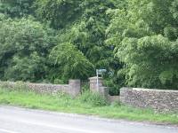
The Cotswold Way entering Dodington Park
Having followed the road or footpath northwestwards from Tormarton or from any of the routes that bypass it to the west, you cross the A46 at a bend, go through a narrow ribbon of trees and find yourself in Dodington Park.
Dodington Park
The park is the estate of Dodington House,
the second stately home of the day. The house itself lays to the west
and
features formal gardens laid out by Capability Brown. One of my
guidebooks
on the CW indicates that the house and gardens are open to the public,
but a correspondent informed me a couple of years ago that this is no
longer the case. More recently a local resident sent me this info:
"At that time the owner was Sir Christopher Codrington, whose ancestors had (so I
understand) acquired the property via the gains from slave trading. Unfortunately
Sir Christopher fell foul of ill health, and he sold the place and then lived in an adjacent cottage. He
died in late 2005. The mansion is now owned by Mr
James Dyson, the inventor of the bag-less vacuum among other things."
The Way is well signed through the park, consisting mostly of a grassy rake across downy pastures fringed with clumps of woodland. A coombe holding the river Frome lays to your left initially, but after some 1200m you hit the steepest part of the scarp slope.
The Cotswold Way in Dodington park
Scenes in Dodington Park
The path passes the corner of a wood and turns slightly left to come out onto a country lane at Coomb's End. Dodington lays down the road to the left; the Cotswold Way goes to the right.
The lane into Old Sodbury
You reach the first houses in Old Sodbury shortly after, and in another 150m the official route of the Cotswold Way merges from the right after coming downhill across fields. You probably won't see it but the lane into the village runs almost over the top of the western portal of Sodbury Tunnel, the Great Western Railway's 3.3km long tunnel under the Cotswolds.
Old Sodbury
Our first day's walk ends as you reach the crossroads in the centre of the village.
![]() Old Sodbury lies on the bus route between Bath and Stroud. There is no
timetable information available online but the bus runs Mondays to
Saturdays
and the last bus to Bath is around 4.50 pm. Other, less frequent,
routes
serve Tetbury and Swindon. There is also a service into Chipping
Sodbury,
a mile to the west, from where you can pick up a bus to Bristol.
Old Sodbury lies on the bus route between Bath and Stroud. There is no
timetable information available online but the bus runs Mondays to
Saturdays
and the last bus to Bath is around 4.50 pm. Other, less frequent,
routes
serve Tetbury and Swindon. There is also a service into Chipping
Sodbury,
a mile to the west, from where you can pick up a bus to Bristol.
![]() First
Badgerline service 341/342,
Chipping Sodbury - Yate - Bristol
First
Badgerline service 341/342,
Chipping Sodbury - Yate - Bristol
|
£4.50
inclusive
of postage / packing. |
| Temple Cloud to Bath | Back to Cotswold Way index | Old Sodbury to Wotton-under-Edge |
This page last updated 5th March 2005
![]()