

| Millers Dale to Castleton | Back to White Peak Way index | Edale to Snake Pass |


| Millers Dale to Castleton | Back to White Peak Way index | Edale to Snake Pass |
There are two reasons for this. Firstly, you could easily complete the White Peak walk in three days, not four, but the final day - of which this section would constitute the afternoon - would be a little too full for comfort. The second, and more valid, reason, is that there are enough available diversions for this short walk actually to occupy a full day. Apart from doing the "tourist bit" in Castleton itself there are no less than four show caves open to the public; Peak Cavern, Speedwell, Treak Cliff and Blue John; plus a highly recommended off-route spur to Lose Hill. I'll not go into any details of the caves themselves in this introduction, save to say that they are highly individual, all worth seeing, and that their websites are listed below under "links". You might also consider a visit to Peveril Castle.
The walk takes in the interesting little fell of Mam Tor, otherwise known as the "shivering mountain". This 517m summit is composed of closely-spaced layers of rather shaly bedrock and its steep southeastern face erodes very readily. The main A625 Sheffield to Chapel-en-le-Frith road used to run along the lower reaches of this slope. Used to, for it has been partially undercut by landslips enough times for the highway authority to give up on it and close it. Thus, two legs of the A625 approach Mam Tor from opposite sides but fail to meet. Through traffic has to negotiate the steep and narrow defile of Winnat's Pass instead, and this is a road quite unsuitable for any vehicle larger that the standard motor car.
Mam Tor is a prime site for hang gliding, and you will rarely come up here in the hours of daylight without seeing at least one gaily coloured canopy riding the thermals nearby. My route ascends the tor by means of the direct path to the left of the steep face, but as an erosion control measure this route is presently discouraged. You are supposed to follow the road for a quarter of a mile west from the Blue John caves and take the flagged "granny path" up from the car park. I feel that this path is a visual intrusion that has no place in a mountain environment, but I'll leave it up to you and your conscience which route you take.
Mam Tor lies at the western end of a delightful ridge route approaching three miles in length, falling to the col of Hollins Cross (where seven footpaths converge) and then rising again to the curious eminence of Black Tor and finally Lose Hill. Taking the spur out to Lose Hill adds three miles to your day's tally. Back at Hollins Cross you take the falling northwestern path off the ridge to descend to Edale where you fetch up opposite the church, halfway between the railway halt and the official start of the Pennine Way.
|
|
|
| Length: | 4.16 miles / 6.69 km |
| Total ascent: | 1294 ft / 394 m |
| Total descent: | 1114 ft / 340 m |
| Estimated time: | 1 hr 51 mins |
Map: OS 1:25000 Outdoor Leisure 1 (The Dark Peak)
Click on
any thumbnail image in this gallery to display the corresponding full
size
image. The images are access protected through a cgi script to prevent
hotlinking. If you encounter problems while trying to view the full
size
images, please read the access advice
page.
Scenes in Castleton
Castleton is a gem of a village - stone-built, haphazard, attractive, and ringed by hills. Historically, it is a mining centre. It lays pretty much across the contact between the limestone to the south and the gritstone (a type of hard sandstone) to the north. The contact is home to a number of veins of minerals and ores, and mining and quarrying were once the dominant activities here. Most of the showcaves began their lives as mines, and some extraction still continues. The nearby cement works constitutes the main activity nowadays - it's something of an eyesore, unfortunately, but it is at least well hidden from the village proper. Jobs and livelihoods depend on it so we should not begrudge its existence.
A Castleton photo album
Nowadays, though, Castleton's main industry is tourism. There are guest houses, inns, restaurants and coffee shops, and of course the usual tourist gift outlets for those who don't wander too far from their cars. It's also, fortunately, buzzing with public transport links. Apart from the show caves and the hills, Peveril Castle (seen from yesterday's walk down Cave Dale into the village) dominates the place and is a big draw for visitors.
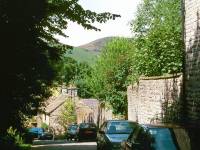
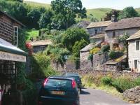
Approaching Peak Cavern from Castleton
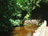
The riverside lane to Peak Cavern
Peak Cavern is your first destination and is just on the edge of the village - follow the signs, and the crowds, along the splendid little streamside path towards the gash in the cliffs below Peveril castle. Peak Cavern is a natural cave - the most extensive in Derbyshire - and that gash in the cliff is the largest cave entrance in Britain.
Entrace to Peak Cavern
Speedwell Lane
Speedwell Cavern is a former lead mine and is surprisingly extensive; the tour of those parts open to the public includes a trip on an underground canal boat which, thanks to the guides, is a thoroughly entertaining experience.


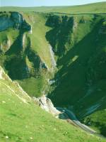
Winnats Pass
Winnats Pass is quite a spectacular feature and its limestone walls rival those of Cheddar Gorge for scenic value. It's worth climbing up the green slopes on the north side for a bird's eye view, as I did to get the pictures above.
From Speedwell Cavern there's a short stretch of footpath running northwest across the foot of the slopes towards Treak Cliff, only 600 meters away - if you miss it, which is very easily done, the abandoned A625 (here serving as a linear car park) runs very close by and heads in precisely the same direction.
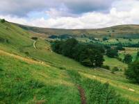
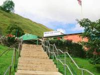
Treak Cliff Cavern is still a working mine. It, along with Blue John Cavern just up the hill, is one of the world's very few sources of bluejohn flourspar, a highly prized ornamental stone. There is a small cafeteria attached to the cave shop.
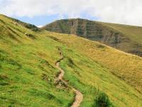

The footpath from Treak Cliff to Blue John; Mam Tor from Blue John Cavern
The footpath to Blue John Cave runs behind and uphill from the entrance to Treak Cliff, rounding a spur and disappearing up into a coombe. According to the map the distance between the two caves is only 500 meters but it does seem to be rather more on foot. The sheer face of Mam Tor appears ahead of you just before you turn into the coombe, looking quite daunting from this angle.
Blue John Cavern is, like Treak Cliff, still worked for bluejohn flourspar and also open to the public as a showcave; once again tours are worthwhile and highly recommended. Bluejohn artefacts and mineral samples are on sale in the cave shop.
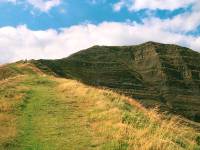
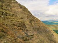
From Blue John Cave it's either a short, steep ascent direct to Mam Tor up the slopes westwards of the sheer face, or the walk up the road to the car park for the gently graded artificial path of flagstones. I'm very surprised at the National Trust's part in this; as a conservation body they are normally much more sensitive to art of making footpath repairs look natural. Not so here, for nothing could look worse. Even a strip of tarmac would actually be better than the massive, angular flagstones set in place all the way up to the summit.
Approaching the summit; looking back at Castleton; Edale and hang gliders
The 1696ft summit of Mam Tor is technically part of the Kinder massif, ultimately connected to it via a long horseshoe around the head of the Hope valley, it explains why the Tor fails to appear in any summit-baggers' list such as the Marylins. Sod that - it's an exhilarating little summit and well worth doing. Views are excellent, particularly down into the Hope valley to the north, where the valley of Grindsbrook Clough - which carries the Pennine Way out of Edale up to Kinder - is a very obvious feature. Castleton is well seen, of course (though unfortunately the cement works are prominent from here), but perhaps the most inviting scene is the ridge path down to Hollins Cross and on to Black Tor and Lose Hill.
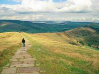

The Mam Tor - Hollins Cross path
It's just about a mile from Mam Tor down to the col at Hollins Cross, and it's a gentle downhill amble along the crest of the ridge all the way. It's a great pity that the NT have continued the flagstone theme, though at least the slabs do become smaller and less regular as you progress.
Seven paths meet at the 400m col of Hollins Cross; the ridge paths running east and west, paths down the south slope to Mam farm and Castleton, and paths down the north slope to Blacktor Farm, Greenlands Farm, and Edale via Hollins Farm. The latter path is our route, of course, but I heartily recommend the diversion out along the ridge path to Lose Hill and back.
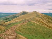
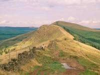
It's a return journey of three miles from Hollins Cross to Lose Hill and back, along the same delightful ridge path. Views southwards to Castleton and Hope, and northwards into the Hope valley, are superb. The highlight, though, is the amazing little topknott of Black Tor; almost a miniature Mam Tor, but with its steep shaly slope facing northwest rather than southeast, it's quite a steep pull up to the summit. Beyond Black Tor the flagstones return as far as Lose Hill, the 476m summit at the eastern end of the ridge, where you'll find a topograph.
There is another path off the ridge from the col west of Black Tor, but it's inferior to the Edale path from Hollins Cross.
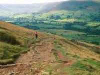

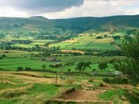
The Hollins Cross - Hollins Farm path
The path down to Hollins Farm from the col is really quite splendid, well defined and giving glorious views across the Hope Valley's patchwork of pastures and hedgerows.
The environs of Hollins Farm
From Hollins, follow the track down shallower slopes to come out at a bridge over the River Noe, just beyond which is the Edale road.
The footpath from Hollins Farm to the Hope Valley road
Cross the road to find another footpath, which leads across a pasture to dive under the railway via a simple bridge. Thereafter the path kinks to the left, crossing two more pastures, before running beside a small woodland plantation to disgorge you slap into the middle of Edale - just opposite the church and right beside the tourist information office and the campsite.
The cross-field paths from the road to Edale
Technically you should turn right and walk the four hundred yards up the lane to the Nag's Head, the official end of this White Peak way and the start of the Pennine Way. Four hundred yards to your left, conversely, is Edale's railway halt with regular services to Sheffield (about 40 minutes away) and Manchester (about 50 minutes), or New Mills for more local bus connections.
![]() Stagecoach
East Midlands service 260, Castleton
- Caves - Edale
Stagecoach
East Midlands service 260, Castleton
- Caves - Edale
![]() Manchester
- Edale - Hope - Sheffield
Manchester
- Edale - Hope - Sheffield
| Millers Dale to Castleton | Back to White Peak Way index | Edale to Snake Pass |
This page last updated 8th January 2005
![]()