|
The ascent from Pitlochry involves
walking
up either East or West Moulin Road as far as the village of Moulin,
taking
a lane to the left (which heads for the Craigower golf course) and then
another lane to the right which ends at a car park. Drivers can save
themselves
this first mile and will probably "do" the hill in half a day. There's
around 1500ft of ascent involved, making the climb of Vrackie the
equivalent
of an average Lakeland ascent. The route beyond the farm takes a track
beside, then through, a forest plantation to emerge here in open
country
with about a mile and a half to walk. |
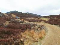 |
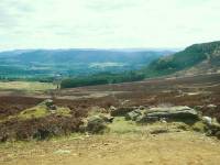
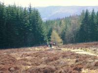
Initially there's a good landrover
track
which aids swift progress, traversing the rather gloomy moorland on the
southern slopes of Creag Bhreac. |
 |
The track runs over a shallow col
between
Creag Bhreac and Meall na h-Aodainn Moire, at 518m. The summit dome of
Vrackie stands ahead of you now, just three quarters of a mile away.
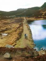
The
track drops to cross the earth dam of the tiny Loch a Choire (corrie
lake). |
 |
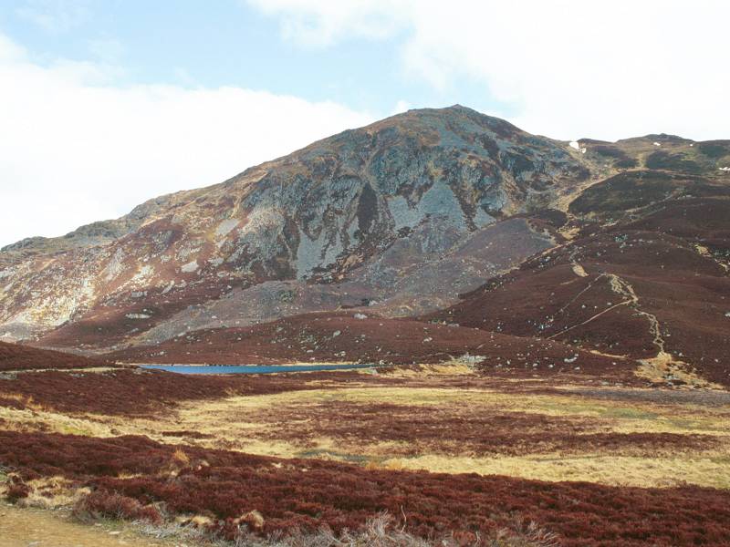
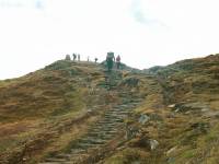
The route now lies directly up the
corrie
just east of Vrackie's summit and it looks daunting from below, but
there
is a good "made" path fashioned into rocksteps. I'm always in two minds
about these cobbled paths - they aid progress, prevent erosion and
avoid
mudbaths and stamina-sapping slogs up stony chutes. On the other hand
they
simply look wrong in a mountain environment - mountain walking is an
escapist
pursuit and you want the environment to look as natural as possible.
Artificial
paths detract from the experience. |
 |
Halfway up the main drag and
already a view
is opening up to the west. Schiehallion is peeping out above the loch. |
|
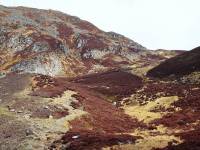
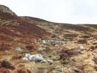
That's a bit more like it -
primeval scenes
of heather-covered rock as you ascend the corrie. |
|
A pause to look back at the ascent
route.
Despite the bright weather the atmosphere is gloomy - this would be a
depressing
walk in wet weather. |
|
Well above 2000ft now as a view
begins to
open up along Loch Tummel to the west. |
|
It requires physical effort, as do
all mountain
ascents, but it's completely straightforward and you soon find yourself
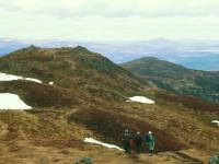
approaching the skyline col between Vrackie and its eastern top. |

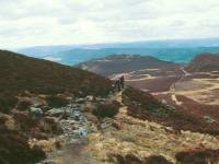
|
The skyline is reached and gives
this glorious
view back towards Pitlochry. Now to turn left for the summit. |
|
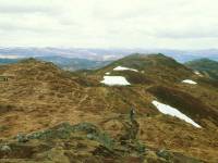
The summit arrives quickly -
despite this
being my first walk of the season I didn't feel stretched in any way.
It
almost felt like cheating to have arrived at the top of a Scottish
mountain
without feeling shattered. |
|
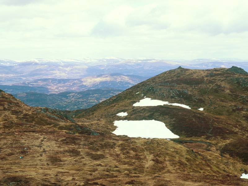
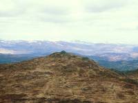
Looking back at the east top.
Patches of
snow lying on south facing slopes shows how early in the
season
it still is. |

|
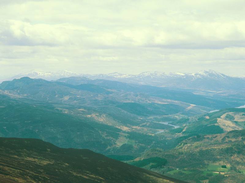
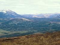
Your gaze is immediately drawn
westwards
from the summit to the Perthshire munros - the range from Ben Lawers to
Schiehallion is seen pretty much end-on, with the trench of Loch Tummel
to the right. |
|
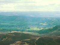
Pitlochry and Loch Faskally from
the summit.
There's a topograph on the summit which shows pretty much everything in
view - Vrackie is a splendid viewpoint from which most of the Grampian
mountains are visible. The view extends from Arthur's Seat in Edinburgh
round to Ben Nevis. |

|
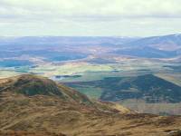
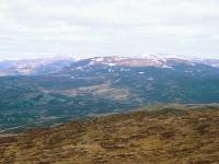
Summit panorama 1, looking
southwest - Ben
Lawers is the peak on the left with all the snow. The hill on the right
is Schiehallion. |

|
Summit panorama 2. Looking south of
west
along the trench of Loch Tummel. Schiehallion is on the left. Although
it's not clear enough to make out detail, you can see the snow-topped
Blackmount
and Glencoe peaks on the far side of Rannoch Moor, beyond the head of
Loch
Tummel. I was able to make out Buachaille Etive Mor. |

|
Summit panorama 3, north of west.
Kiiliecrankie
and Glen Garry are in the foreground, with Blair Atholl visible. The
snow-covered
peaks in the background include Ben Nevis, the Mamores and the Ben
Alder
group. |

|
Summit panorama 4. Northwestwards
to Ben
Alder and the hills west of Drumochter. |
|
Summit Panorama 5, and the high
glens east
of Blair Atholl that lead into the Mounth. The lake is Loch Moraig,
about
3 miles away. |

|
Summit panorama 6, just west of
north, the
Drumochter hills and the Gaick pass, with Beinn Dearg prominent. |
|
Summit panorama 7, northwards to
the Glen
Tilt hills - that's Carn Liath in the centre of shot, |
|
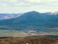
Summit panorama 8 - the Beinn a
Ghlo massif,
looking magnificent from here. |

|
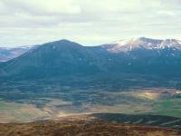
Summit panorama 9 - the Beinn a
Ghlo massif
continues, including Braigh Coire Cruinn-bhalgain, the Bealach na
Fhiodha
and the 3678ft Carn nan Ganhar on the right. One of the high
Cairngorms,
possibly Macdui or Cairn Toul, is seen through the bealach. |
|
Summit panorama 10, towards the
northeast
- Ben Avon and its neighbours seen over the central Mounth. |
|
Summit panorama 11, to the
northeast, looking
at the west Mounth hills including Carn am Righ and Beinn Iutharn Mhor. |

|
Summit panorama 12. Not completely
sure of
my bearings here but those must be the Cairnwell mountains in the
distance. |
|
Summit panorama 13. The southern
approaches
to the Mounth towards Spittal of Glenshee, overtopped by Glas Maol and
Lochnagar. |

|
Summit panorama 14. The east top,
the desolate
moors around Glenshee, and Driesh and Mayar in the distance. |
|
Summit panorama 15, looking east
towards
the hills around Glen Isla in Angus. |
|
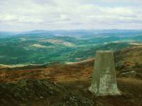
The summit trig pillar, with Glen
Garry and
Blair Atholl in the background. |
|
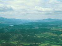
A telephoto shot along the length
of Loch
Tummel, with the Blackmount and Glencoe peaks on the skyline. |
|
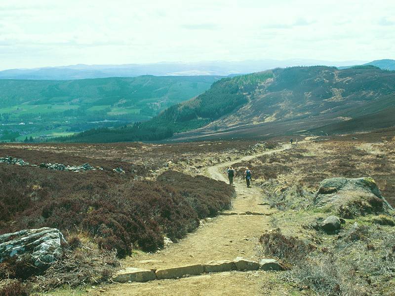
After lunch it was a leisurely
descent back
to Pitlochry. The Loch Choire dam again. |

|
Just as I'm well on the way back
the sun
comes out, transforming the sombre landscape. |

|
A really pleasant amble back along
the landrover
track. |

|
The sunshine brings out the rich
colours
of the moor. |
|
Pitlochry draws nearer. |
|
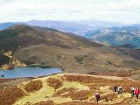
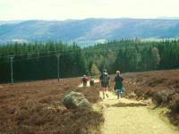
Back near the woods now, and
suddenly there
are dozens of walkers about. |
|
Entering the woodland stretch above
Moulin |
|
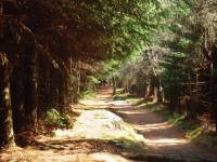
...which was gloomy on the ascent
but is
now very pleasant and inviting in the sunshine |

|
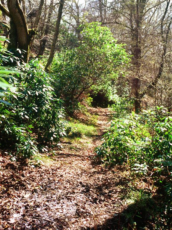
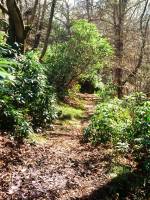
Woodland track above Moulin |
|
The track emerges at the side of
the forest,
with the sounds of a clay pigeon shoot not far to the right. |
|
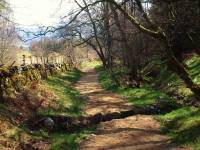
A diversion along a simple path to
the right
of the main track adds variety to the descent. A few minutes later I
reached
the car park, which was very full - there were also a couple of dozen
cars
parked awkwardly along the lane back into Moulin. I reached Pitlochry
on
foot around 3pm and, after a shower, spent the afternoon lazing on the
shores of Loch Faskally. |