Glencoe

Glencoe is a small area with a big presence.
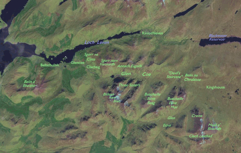
The valley, about 14 miles long and situated a dozen miles south of
Fort
William, is the centre of some of Scotland's most dramatic mountain
scenery
and the site of some of its most turbulent history. It is not exactly
isolated
- the main A82 trunk road from Glasgow to the highlands runs through
the
middle of the glen, the present road dating from major improvements in
the 1930's. The glen begins at the corner of Rannoch Moor in the east,
and runs generally due west to emerge at Glencoe village on the shore
of
Loch Leven. On the south side of the glen is the fine mountain group of
Bidean nam Bian, the highest peak in the former county of Argyll; the
dramatic
cone of Buachaille Etive Mor (the Great Shepherd of Etive) lays on the
same side of the glen just a handful of miles to the east. Much of the
glen's north wall consists of the celebrated Aonach Eagach - the
Notched
Ridge (or Ridge of Teeth, using just a little poetic licence in the
translation
from Gaelic). Pretty nearly all the high level routes in this area are
tricky scrambles and are not really for the ordinary walker. The West
Highland
Way, however, impinges on the eastern corner of the glen.
I don't have very many images of Glencoe,
and those that I do posess are "tourist" shots taken in the floor of
the
glen. Later I shall be adding images of the West Highland Way
(duplicated
from the End-to-End Walk page of my website) but for now there is a
single
gallery of miscellaneous shots taken over the years.
Gallery Index
Back to Scottish Highlands index page
This page last updated 20th January 2005


![]()