 |
Curiously there's no path at first.
You just
walk eastwards off Cairngorm's summit dome and pick your way down using
the rounded stones as a natural stairway. Coire Cas (Steep Corrie) lies
to your right and you reach a shallow col between it and the shallower
Coire Raibert (Robert's Corrie) to your left. From here on there's a
very
significant path. There's a very slight rise to Fiacaill a Choire Cas,
and a ridge descending to the right makes a delightful return route
forming
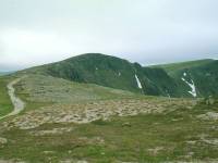
a simple expedition. The main ridge now turns south to swing around the
lip of Coire an-t Sneachda (the Snow Corrie). The path drops to a
shallow
col at 1099m, seen here. |
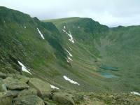 |
The path hugs the lip of Coire an-t
Sneachda.
The corrie is about 1200m across but contrives to look much bigger. Its
headwall faces north, which is why - as late as the year in July, when
these pictures were taken - it still holds patches of snow from the
previous
winter. |
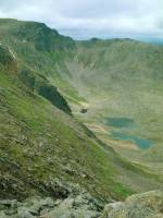 |
A cluster of small lochans lay in
the corrie
floor, and the opposite wall is formed of a ridge known as the Fiacaill
Coire an-t Sneachda, the only terrain in the Cairngorms that is too
tricky
for the ordinary walker. |
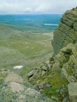 |
The lip of the corrie curves round
to the
east, and here Loch Morlich comes into view behind a wind-sculptured
buttress
of granite. |
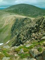 |
This is the 1176m (3850ft) summit
of Stob
Coire an-t Sneachda, the highest point of the corrie headwall, and it's
worth mentioning that this point is higher than all but fifteen of
Scotland's
principal mountains. Here we're about a mile southwest of Cairngorm
itself,
seen here as a gently rounded dome. |

|
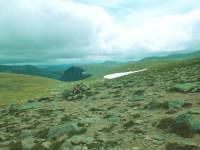
The path drops to this col at 1111m
elevation
as it continues around the rim of the corrie. Here we're not far short
of the Fiacaill Buttress, the top of a difficult scrambly ridge out of
bounds to the ordinary walker. |
|
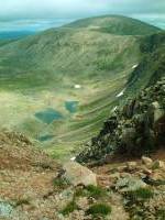
We mustn't forget the views in
other directions.
This southeastern aspect looks across the shallow depression of Coire
Domhain,
which slopes gently downhill at first then drops suddenly to the trench
of Loch Avon, unseen from here. The obvious cleft just left of centre
is
Coire Etchachan, with Derry Cairngorm to its right, sloping away into
Glen
Derry. Coire Etchachan is 3km (2 miles) away. |
|
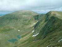
Adjacent to the top of the Fiacaill
Buttress
now, we can see right across the headwall of Coire an-t Sneachda from
the
western side. Cairngorm itself (1245m, or 4088ft) towers over
everything. |
|
From just a little further round, the
snow
patches and Stob Coire an-t Sneachda are well seen. |
|
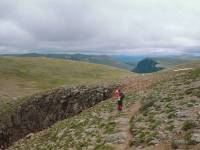
There is still a significant path
here, testimony
to the popularity of this walk. We've just passed the point where the
path
splits, the southern fork going off to cross the high plateau to Beinn
Macdui. Here we see Coire Etchachan again, with Beinn Mheadhoin
(pronounced
Ben Vane and meaning Middle Mountain) rising to the left. |
|
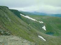
The one shot I got of Coire an
Lochain before
the film ran out. Coire an Lochain is almost a repeat of Coire an-t
Sneachda,
a north-facing bowl hemmed in by a granite headwall and two descending
ridges. The flat summit up to the left is Cairn Lochan, 1215m or
3983ft,
and is the highest point of the corrie headwall. Carn Lochan is
regarded
as a "top" of Cairngorm but there has been something of a debate as to
whether it merits being regarded as a principal mountain in its own
right.
If it were, it would be the tenth highest in Britain. Sgor Gaoith and
Carn
Ban Mor are just seen poking up behind the far ridge. |
|
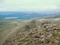
The Fiacaill ridge, separating
Coire an-t
Sneachda from Coire an Lochain. The difficult, scrambly pitch is not
seen
from here.
I ran out of film here. The
remainder of my
walk took me along the rim of Coire an Lochain and then down the
northeast
ridge of Lurcher's Crag to the corrie floor. The path back to the
Cairngorm
chairlift is straightforward except for the point at which it crosses
the
burn flowing out of Coire an-t Sneachda - the burn has to be jumped and
this could be hazardous in wet weather.
|
![]()