Click
on
any thumbnail image in this gallery to display the corresponding full
size
image. The images are access protected through a cgi script to prevent
hotlinking. If you encounter problems while trying to view the full
size
images, please read the access advice
page.
Slightly to the east the Loop dives down an alley to the waterside and runs past some smart riverside apartments, passing Erith pier.
Past the pier the Loop heads away from the river again, passing a supermarket on the edge of Erith town centre and then running east through an industrial estate to reach the edge of the built-up area.
You reach Crayford Ness, a point at which the Thames bends to the right to run southeast. A number of signs tell you that you're following the Thames Path and the Cray River Route. Slightly further along, an older and rather fancier double fingerpost, its upright member reflecting the meanders of the river, gives the distances to various places along the riverbank.
Five hundred metres beyond Crayford Ness you come to the river Darent. You're on the edge of London now. To your left, across the Thames, is Essex; ahead of you, across the Darent, is Kent. The corner of the capital is marked by an area of scrub on which two lonely shrubs have made their home.
After the industrial area is left behind things improve remarkably. Areas of lush river meadows line each side of the Darent; Dartford Marshes on the far side, Crayford Marshes to the near side. Horses graze among clumps of vegetation and the housing estates of Slade Green are seen beyond.
A side path runs off to Slade Green (first image above), after which the meadows to the right rise to form a low mound, possibly a grassed-over landfill site. Surprisingly, none of the central London sights such as Canary Wharf can be seen - we're simply too far out, for even Docklands is ten miles away. We continue alongside the Darent until it's joined by a tributary, the Cray.
The Loop runs southeast across the river bridge then turns right to follow the south bank of the Cray, past residential back gardens.
The path emerges onto a main road and then runs along a residential road on the opposite side before rejoining the Cray on the north bank.
From the gardens the Loop follows London Road from the busy junction to the west, then forks left into Bourne Road.
Hall Place was once a country estate; nowadays it's something of an anomaly, surrounded as it is by London. But it's open to the public and worth a visit in its own right. Some other time, for the Loop skirts the grounds to the east and south to come up against the barrier of the A2 trunk road. A flight of steps leads up to the roadside. Follow the footway south across the rail viaduct then take the sloping path downwards. This doubles back on itself to come up against the railway line and then swings to the left to pass under the viaduct. Turn left again beyond here to run past a high security fence then go right for a footpath alongside Churchfield Wood.
The path kinks to the left for a short time and reaches the edge of the housing estate beyond, but the Loop now swings hard right onto a surfaced path running in a straight line between fences and hedges.
Old Bexley is a town of character and charm. Sir Edward Heath, former Prime Minister, was the MP for this area. The first section of the Loop ends here. Follow the road into the town centre and turn left, and in a couple of hundred metres you arrive at Bexley railway station.
The Loop now goes along Tanyard Lane, just short of the railway station. It crosses the railway line via an underbridge and turns right, hugging the south side of the line alongside a couple of sports grounds.
Just past the cricket pitch the Loop passes a row of cottages, quite possibly the most isolated houses in the whole of London. From here it mounts a bank to cross an are of restored landfill, heading towards the Albany Park housing estate.
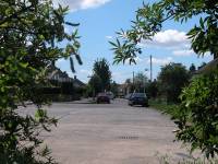
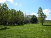
The Loop reaches the corner of the housing estate after crossing the landfill area. Start walking along the road, but take the first turning left, which takes you along a path bounded by high iron railings. There is a waterworks to your left and an open plantation of trees to the right.
The path reaches the river Cray once more. Cross by the footbridge and turn right. The next mile or so is quite delightful, a world of trees, water and river meadows.
The loop continues alongside the Cray, between North Cray and Foots Cray.
Pastures abut the river to either side, and there's very little sign of the vast sprawl of London.
Eventually, Five Arch Bridge is reached.
This is a particularly lovely spot. There is a weir directly beneath the bridge, and upstream the Cray has widened to form a small lake.
The riverside theme continues as the Loop accompanies the Cray through Foots Cray Meadows.
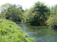
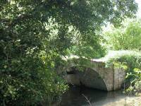
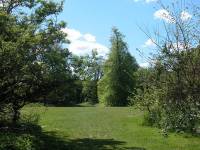
The riverside section eventually comes to an end as you approach Foots Cray proper. Turn right onto a brick arch bridge across the river (centre photo above) and keep straight on for a hundred metres or so, then bear left across an open grassy area. The route here is a little confusing but if you go to the right again at the far end you should find yourself climbing a bank to come to a road beside a school.
This is Foots Cray, and is a short section of urban bustle. The Loop turns left to go down the road to the crossroads. There are a few useful shops here for those in need of refreshment, and if you wish to end the walk here buses will take you into Sidcup or Bromley. Go straight on at the crossroads then take the second right along Suffolk Road. Towards the end of this road go slightly left along a footpath.
At first the footpath skirts a recreation ground but then it continues between the backs of the houses of Foots Cray to the right and some rather unkempt areas of open ground to the left. Among these is the Cray Wanderers football pitch. After half a mile or so things improve and you pass through a screen of trees to enter Sidcup Place Park.
Make your way up to the top right of the park, where you will find the handsome building of Sidcup Place and its ornamental flower beds. There are some bench seats around here, a handy place to have your lunch if you started out from Old Bexley.
From Sidcup Place a road runs to the south along the edge of the park. Walk along the path (or stay within the park if you prefer) towards Queen Mary's Hospital, where the warren of slip roads and service roads is confusing. Beyond the hospital is the A20, and the borough boundary between Bexley and Bromley. The A20 is crossed by means of a complex of underpasses.
Back to Borough of Bexley index page
|
All Bexley London Loop images on one disc, 250 images, £7.00 |
This page last updated 12th January 2005
![]()