|
Once
I reached Far Sawrey I turned off right onto the fell path. The sun had
appeared, albeit very briefly, and it felt good to be out on the fells
for the first time this year.
|
|
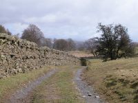
About half a mile out from Far Sawrey the route to Claife Heights turns right onto another track, heading north
|
|
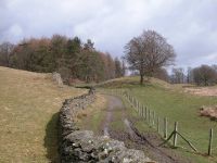
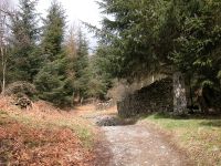
The track approaches woodland, an outlier of the extensive Grizedale plantations between Windermere and Coniston.
|
|
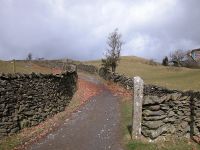
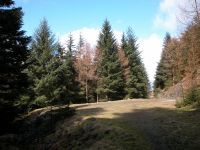
The track is a long one and alternates between patches of forest and open pasture.
|
|
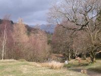
A
sighting of the distant Ill Bell ridge. It's a pity that the trees are
not yet in leaf. This scene will be beautiful in four weeks' time.
|
|
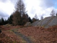
Further
into the forest. Not far ahead is the limestone outcrop of Low Pate
Crag and the path slants up to the right. There were good views of
Windermere from the top of the crag but unfortunately the skies chose
that moment to open and I had to seek shelter from the rain in the
forest. Once the rain cleared up twenty minutes later I discoverd that
the forest track beyond the crag runs through an area of extensive bog,
and proved to be impossible to follow in the current conditions.
Instead I chose a side path running west through the forest,
approaching Claife Heights from the south.
|
|
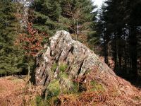
The
rain came down again and this time I had to wait for half an hour.
There was nobody else about and the path was poorly defined and not
easy to follow. In addition the terrain didn't seem to correspond with
the map and I began to wonder if I'd gone astray. Eventually I came to
this limestone crag which I first thought must be the summit of Claife
Heights, but then I noticed there was no Ordnance Survey trig pillar. I
later discovered that this was High Pate Crag but at the time I didn't
have a clue where I was.
|
|
Ten
minutes further on, the path has dropped and risen again and passed
this outcrop. Once again I wondered whether it was the summit of Claife
Heights but it was only later I found out it was a nameless crag at
grid ref 380971 (for those of you following the route on a map).
|
|
It
was only when I happened upon this forest road turning circle a few
minutes later that I finally realised where I was. The true summit lay
250 metres to the northeast and I was able to follow the woodland path
to the right with renewed confidence.
|

|
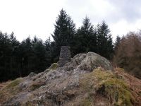
The
path misses the summit crag so it's necessary to climb up to the right
to find it. As the treetops surround the crag there's not really much
of a view, but it's a pleasant little place to be and I settled down in
the lee of the wind for some lunch.
|
|
Back
down to the path, and not a hundred metres further on I found a sign
saying "viewpoint" pointing up to the right. And, would you believe, it
came out just a few paces north of the trig point.
|
|
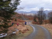
Beyoond
the summit I reached a path junction, and suddenly there were other
walkers around again. Rather than flounder around in the juicy patches
again I decided to find another way back via forest tracks to the west.
I turned left, and after a few minutes I came out onto the forest road
I'd first seen three pictures ago. I followed it past the Windermere TV
mast and then took a side track to the left. When the track petered out
I followed a path to the northwest, turning left again at Hollin Band
Plantation for a route directly back to Far Sawrey.
|
|
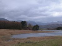
The
route passes three tarns; Highs Moss, then Wise Een Tarn (seen here),
then Moss Eccles Tarn, which is partially surrounded by woods. I'm sure
that is's equally as beautiful as the celebrated Tarn Hows near
Coniston when the sun shines. Someday I must come back and check this
theory out.
|
|
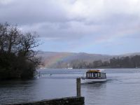
The
weather closed in again on the way back. I hesitated about whether to
patronise the cafe at Far Sawrey but I figured I was a little tight for
the ferry and walked straight back. In the event I made it with a good
twenty minutes to spare. A rainbow appeared as the ferry approached the
landing stage, providing me with the day's final photo opportunity.
|


